|
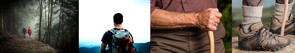
Local walks guide
Than ks to Maureen Maybank of Moss, Pamela Campbell of Kilchoan, Eilidh-Anne Madden our local Ranger, Forest Enterprise, Sunart Oakwoods Initiative, John Dye and others for their help in producing this local walks guide.
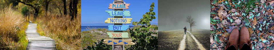
The outdoor access code
The Land Reform (Scotland) Act 2003
establishes a statutory right of responsible access to land and inland waters for: outdoor recreation, crossing land, and some educational and commercial purposes. The three key principles for responsible access apply to both the public and land managers:
Respect the interests of other people: Be considerate, respect privacy and livelihoods and the needs of those enjoying the outdoors.
Care for the Environment: Look after the places you visit and enjoy. Care for wildlife and historic sites.
Take responsibility for your own actions: The outdoors cannot be made risk-free for people exercising access rights; land managers should act with care for people’s safety.
local walks
1. Three walks to Castle Tioram from Acharacle
MAP: OS Explorer 390 Grid ref: 676694
START: Travelling by car there is room to park on a bend near Blain farm.
TERRAIN: A circular walk including spectacular views out to sea. Mostly rough hill walking with some roads. Not suitable for a cycle.
TIME: Three hour round trip dawdle – the views are too good to hurry.
2. EXPEDITION TO LAGA FROM ACHARACLE
MAP: OS Explorer 390 Grid ref: 677682
START: Acharacle School or Arivegaig telephone box.
TERRAIN: A hill walk rising to 300m with possibilities for going higher to a summit. Determined cyclists could make it to the reservoir. Be prepared for the muddy parts a lot of the year.
PLANNING: Drive to Laga early in the morning. Park your car and catch the daily bus to Acharacle (check the timetable). Then transport will be waiting at the end of your walk.
TIME: Four hours with picnic stops: about six miles.
3. WALK TO THE SINGING SANDS, KENTRA TO GORTENFERN
MAP: OS Explorer 390 Grid ref: 650677
START: Park at Arivegaig.
TERRAIN: A level walk along a forestry track to a large, remote, sandy beach. Suitable for bikes.
TIME: It is over three miles to the beach.
Please note the Singing Sands area was formerly MOD property and items containing explosives occasionally may be found in the forest/dune or washed up on the beach.
Anyone finding items they consider to be suspicious is not to disturb them but should immediately contact the local police on 01967 402022.
4. CLIMBING BEN RESIPOL FROM RESIPOL FARM
MAP: OS Pathfinder 288 Grid ref: 722639
START: Resipol Farm
TERRAIN: A mountain climb which can be boggy in parts. Themountain is almost high enough to class as a Munro and you start at loch level. A real expedition.
TIME: A long half day trip.
5. SILVER WALK CIRCUIT NEAR CASTLE TIORAM
MAP: OS Explorer 390 Grid ref: 664714
START: Park by the phone box at Scuirduish (a house on the road to Dorlin) or at Dorlin in the car park.
TERRAIN: A circular walk including spectacular views out to sea. Mostly rough hill walking with an attractive sea cliff path at the end. Extreme caution must be taken on this section of the walk as part of it is now in an unsafe condition. Not suitable for a cycle.
Warning – part of this route is a private path carved from the hillside 130 years ago and is now in a dangerous condition. Please take great care.
TIME: Three hours.
6. GLEN MOIDART
MAP: OS Explorer 390 Grid ref: 740723
START: Turn up Glen Moidart and park at the end of the public road.
TERRAIN: The first part is suitable for a mountain biker. There is a well used track alongside a lochan Loth nan Lochan. For a short trip, visit the reservoir Loch Forslan. Alternatively, follow the stalkers track walk up Glen Moidart. There can be boggy bits along the later sections of this walk.
TIME: This will depend how far you go once you reach the loch.
7. THE ‘OLD ROAD’ KINLOCHMOIDART
MAP: OS Explorer 390 Grid ref: 695728
START: Where single track road becomes full size near Kinacarra restaurant.
TERRAIN: A good woodland walk with no steep gradients.
TIME: One hour depending on how far you go.
8. SMIRISARY NEAR GLENUIG
MAP: OS Explorer 390 Grid ref: 653773
START: Drive out to the village of Glenuig. At Glenuig turn off to the Inn and follow the road to a parking place at its end.
TERRAIN: Not suitable for a mountain biker. There is a rough track to an old crofting community (now sympathetically restored). About a mile beyond the village along an even narrower path there is an unspoilt sandy beach.
TIME: Variable.
9. CAMAS NAN GEALL AND BOURBLAIGE DESERTED VILLAGE SOUTH EAST OF BEN HIANT, KILCHOAN
MAP: OS Explorer 390 Grid ref: 562616
START: Park at viewing point, Grid ref: 563616.
TERRAIN: Unmarked route. Rough going in places, boggy patches and steep slopes. A very good foreshore walk and interesting ruins.
TIME: Two and a half hours circular trip.
10. MINGARY PIER KILCHOAN
MAP: NM OS Explorer 390 Grid ref: 494627 to main road B8007, at 485638
START: Park in ferry car park and walk down towards the ferry waiting room. Access foreshore through small gate on right.
TERRAIN: Mainly rocky and wet with odd boggy sections. Salt marsh over some 150m before the main road. Possibility of seeing seals and otter if you walk very slowly, quietly and avoid being seen.
TIME: An hour’s leisurely stroll along rocky shoreline to the main village and back via the road.
11. BEN HIANT LOCH MUDLE TO THE PEAK
MAP: NM OS Explorer 390 Grid ref: 545653
START: Park off the road in the old sand pit between Loch Mudle entrance and cattle grid.
TERRAIN: Moderate hill walking with rough and boggy patches. The most spectacular views. Take a small scale map to help you identify distant islands, peaks and lochs. Keep a lookout for shead red deer antlers.
TIME: Two and a half hours return trip to summit.
12. PORTUAIRK TO BAY MACNEIL ABOUT SIX MILES NORTH WEST OF KILCHOAN
MAP: OS Explorer 390 Grid ref: 440682
START: Having left Achosnich you cross over a cattle grid, the parking area and rest site is shortly after this on the right.
TERRAIN: Reasonable going.
TIME: One hour return trip.
13. PORTUAIRK TO SANNA BAY ABOUT SIX MILES NORTH WEST OF KILCHOAN
MAP: OS Explorer 390 Grid ref: 440682
START: Having left Achosnich you cross over a cattle grid, the parking area and rest site is shortly after this on the right.
TERRAIN: Reasonable going.
TIME: Two hour return trip: another two hours if you follow the coast along to Glendrian caves.
14A. SONACHAN WOODLAND WALK ABOUT FIVE MILES NORTH WEST OF KILCHOAN
MAP: OS Explorer 390 Grid ref: 448668
START: Just beyond the Sonachan Hotel. Well signed, on left hand side. Park where appropriate. The walk has only recently been formalised by agreement with the landowner in co-operation with the Forestry Authority who are managing the Woodland and Highland Access Network.
TERRAIN: Variable, from good track to boggy and difficult. The wooded area is well known for its rodent population – you will see the newly gnawed hazelnut shells. Rowbuck are present also. About half the area is open. Bracken on the dryer ground, bog, heather and old peat cuttings on the lower area. Grouse can be seen here on occasions.
TIME: Circuit time about one hour.
14B. OLD SCHOOL HOUSE FIVE MILES NORTH WEST OF KILCHOAN
MAP: OS Explorer 390 Grid ref: 448668
START: About half a mile past The Sonachan Hotel. Park off road in the old quarry opposite Highland Access Network sign.
TERRAIN: Rough going with boggy patches. Paths difficult to follow in places.
TIME: About one and a half hours return trip if looping back via Portuairk – or more if going on to Sanna.
15. GLENDRIAN DESERTED VILLAGE NORTH COAST, NORTH OF KILCHOAN
MAP: OS Explorer 390 Grid ref: 469678
START: At the old quarry.
TERRAIN: A fairly easy walk along a farmtrack. A burn near the old village is about 6” deep with stepping stones. A good view of the 55 million year old Ring Dyke can be had from just beyond the kissing gate.
TIME: One and a half to two hours.
16. ORMSAIGBEG HILLS NORTH WEST COAST OF KILCHOAN BAY
MAP: OS Explorer 390 Grid ref: 474648
START: Park near the Kilchoan Fire Station but do not block access.
TERRAIN: Rough going with some boggy patches and steep sections. The superb views of Mull’s north coast and Glen Gorm Castle are really rewarding.
TIME: About two hours.
17. ORMSAIGBEG ROAD WALK NORTH COAST OF KILCHOAN BAY
MAP: OS Explorer 390 Grid ref: 479637
START: Park off road near Ferry Stores.
TERRAIN: Easy westerly walk along the road followed by a grass slope down to shingle beach and back along the fairly rocky coastline.
TIME: One hour gentle return stroll.
18. GLASBHEIN HILLS ABOVE AND THE NORTH OF KILCHOAN
MAP: OS Explorer 390 Grid ref: 477648
START: Park off the road about 100m beyond the first bend, at the track into the hills.
TERRAIN: Moderate, open, hill walking with some rough, boggy and rocky sections. Buzzards and Ravens are often seen here.
TIME: Approx. one hour, depending on you.
19. MINGARY CASTLE AND RAISED BEACH FURTHER EAST HALF MILE EAST OF KILCHOAN
MAP: OS Explorer 390 Grid ref: 520634
START: Park off the B8007 near the entrance to Ardnamurchan Estate main buildings and follow the drive until you pick up direction signs. External viewing of the castle as the walls are unsafe.
TERRAIN: Variable with a ford crossing. Not too strenuous.
TIME: Two hours.
20. OCKLE TO GORTENFERN NORTH COAST, NORTH EAST OF KILCHOAN
MAP: OS Explorer 390 Grid ref: 556704
START: Park in small car park at Ockle.
TERRAIN: Mix of good and rough going with some boggy patches. Spectacular views to Rhum, Muck, Eigg, Skye and Arisaig coastline: beautiful beach at Gorten.
TIME: Five hours return trip or six and a half if going on to Kentra (you will need a lift back).
21. ACHATENY BEACH NORTH COAST, NORTH OF KILCHOAN
MAP: OS Explorer 390 Grid ref: 505705
START: Turn left, just before Achateny, heading for Fascadale. About halfway to Kilchoan you will see a farm gate and track with a stile. Park off the road.
TERRAIN: Country walk.
TIME: About one hour round trip.
22. KILMORY BEACH NORTH COAST, NORTH OF KILCHOAN
MAP: OS Explorer 390 Grid ref: 529702
START: Park off the road 200m past the old Kilmory Post Office/Caalmogo.
TERRAIN: Easy track to beach. Mix of flat sand and rocky outcrops on shore. Spectacular views to Muck, Rhum, Eigg and Skye. Good beach for birdwatching.
TIME: Variable.
23. ARDNASTAING TO SCOTSTOWN FROM STRONTIAN VILLAGE
MAP: OS Explorer 391
START: There is car parking near the Ben View Hotel, 100mup the road off the A861, amilewest of Strontian.
TERRAIN: Good going on paths, tracks and the public road.
TIME: Two hours round trip.
24. CORRANTEE LEAD MINES FROM POLLOCH, NORTH OF STRONTIAN
MAP: OS Explorer 390/391
START: Leave cars in the sandpit, (opposite tall pines on right hand side of road) at the west end of Loch Doilet.
TERRAIN: Mostly easy-to-follow tracks but rather wet in places, some steep sections.
TIME: Two hours to lead mines and back: three hours if walking on to Strontian.
25. LOCH SHIEL FROM POLLOCH, NORTH OF STRONTIAN
MAP: OS Explorer 390/391
START: There is a large car park at the end of the public road in Polloch.
TERRAIN: Good going on paths, through forestry. Beautiful views over Loch Shiel and spectacular vistas on car trip to this walks.
TIME: One and a half hours.
26. ARIUNDLE OAKWOOD STRONTIAN RIVER NORTH OF STRONTIAN
MAP: OS Explorer 391 Grid ref: 826633
START: From the car park, well signed, a few hundred metres up the lane off the Polloch Road.
TERRAIN: Good going on paths, wet in places, along the river and returning through oakwoods. Beautiful woodland walk.
TIME: Two and a half hours.
27. STRONTIAN VILLAGE WOODS
MAP: OS Explorer 391 Grid ref: 815615
START: There is a car park in the village. The walk starts 100m away, just over the Strontian bridge.
TERRAIN: Good going on paths.
TIME: One hour.
28. GARBH EILEAN WILDLIFE HIDE TWO MILES EAST OF RESIPOLE CAMP SITE
MAP: OS Explorer 390 Grid ref: 748618
START: There is a signed car park, plus a Disabled Badge Holder’s car park 500 metres further West.
TERRAIN: Good going on paths.
TIME: One hour.
29. SALEN OAKWOODS TWO SHORT WALKS
MAP: OS Explorer 390 Grid ref: 692643
START: There is a car park 100meast of Salen junction.
TERRAIN: Good going on paths, with some steep slopes. Beautiful view over Salen Bay. Rare plants.
TIME: An hour for the longer route, half an hour for the shorter.
30.GLENBORRODALE RSPB RESERVE GLENMORE BAY, A MILE WEST OF GLENBORRODALE CASTLE
MAP: OS Explorer 390 Grid ref: 592620
START: Park in new car park 400m west of Glenborrodale Castle.
TERRAIN: Reasonable going, wet in places. Wide variety of bird and plant life.
TIME: One hour.
31. SAILEAN NAN CUILEAG NEAR SALEN
MAP: OS Explorer 390 Grid ref: 702644
START: There is a signed car park beside the road.
TERRAIN: Good going on paths with some steep slopes:more informal near shore for which waterproof footwear is recommended.
TIME: Three quarters of an hour.
32. DUN GHALLAIN JUST EAST OF LAGA BAY
MAP: OS Explorer 390 Grid ref: 650607
START: There is a signed car park beside the road. Cross the forest fence at the nearby stile.
TERRAIN: An informal walk for which boots are recommended. Care is needed as the walk has been designed to be as natural as possible.
TIME: One hour.
33. ARDGOUR LOCHANS ARDGOUR
MAP: OS Explorer 391 Grid ref: 016637
START: There is room to park at the Inn at Ardgour.
TERRAIN: A circular walk on level tracks and roads. Also suitable for bicycles.
TIME: One and a half hours.
34. THE CROFTERS WOODLAND CAMUSNAGAUL, ARDGOUR
MAP: OS Explorer 391 Grid ref: 095751
START: There is a parking area by the Camusnagaul passenger ferry.
TERRAIN: A circular route of rough paths which is boggy and steep in places.
TIME: One and a half hours.
35. INNIEMORE DESERTED TOWNSHIP MORVERN / LOCHALINE AREA
MAP: OS Explorer 383 Grid ref: 668517
START: There is a signed car park between Loch Arienas and Loch Teacuis.
TERRAIN: Good going on paths but some steeper slopes.
TIME: One and a half hours.
36. ARDTORNISH ESTATE 3 MILES NORTH OF LOCHALINE
MAP: OS Explorer 383 Grid ref: 703484
START: Visitors are requested to seek guidance from the Ardtornish Estate Office near the Ardtornish Gardens.
TERRAIN: A variety of walks as advised by the office.
TIME: Variable.
37. ARDMOLICH WOODLAND WALK OVERLOOKING LOCH MOIDART
MAP: OS Explorer 390 Grid ref: 715715
START: There is a small car park beside the A861 between Langal & Kinlochmoidart.
TERRAIN: Easy walking on paths with some challenging climbs. Upper loops more informal for which boots are recommended. Stunning views over Loch Moidart and out to the Small Isles.
TIME: Two and a half hours.
38. RAHOY HILLS WILDLIFE RESERVE CAR PARK ON A884 AT ACHARN, FOUR MILES NORTH OF LOCHALINE
MAP: OS Explorer 383 Grid ref: NM 702505
START: Bridge below the small car park on the edge of the oakwood. SWT Reserve Warden Wednesday walks 2pm April-October.
TERRAIN: Well-formed grass track, grading progressively to rough open hill and woodland, with bridges across the main burns.
TIME: The two mile walk takes one – two hours there and back.
History walks
In the last 250 years Moidart, like most of the Highlands, has undergone dramatic changes in landscape, in population, in social and economic conditions and in language and culture. The evidence for these changes is still highly visible in Moidart because little development has occurred to destroy it. The History Group is a group of volunteer enthusiasts who, as well as researching and cataloguing the evidence, have produced some guides so that you can see some of it for yourself and learn and understand the changes which have taken place in our community. Much of what you will learn about Moidart will lead you on to a better understanding of the West Highlands in general. By following the walks you will also visit some wonderful locations which you might otherwise have passed by.
Details of these walks
These walks are covered in more detail in leaflets provided by Moidart Local History Group. Each leaflet costs £1 and contains detailed information on how to follow the walks, sketch maps and historical background to the sites being visited. We are a voluntary non-profit-making group and the profits from sale of the leaflets are used to further our research work and to present it to the public. The leaflets can be purchased at the following outlets:
Glenuig Shop Acharacle Shop
Glenuig Inn Lochailort Inn
Strontian Tourist Information Centre
Kilchoan Tourist Information Centre
1. Caolas Mòr Glenuig
Visit a large village, deserted since 1870, Caolas Mòr (pronounced kölas more), an illegal still house, and an intact grain and malt drying kiln. This is an easy walk but once you leave the pathway to explore the old village the ground is wet in places and walking boots or wellies are advisable. From Glenuig drive over the Bealach Carach (pronounced byalachkarach). Bealach means pass. Park at the first gateway on the right from where the walk begins.
Time: about two hours.
Distance: about one mile.
2. Eagnaig and Bad an Dòbhran north shore of Loch Moidart
Visit three deserted villages, a small disused graveyard, an illegal whisky distiller’s hideaway and the whisky exciseman’s house. Quite a demanding walk. This walk begins at Caolar Mòr (see Walk number 1) between Glenuig and Kinlochmoidart and continues round the north shore of the North Channel of Loch Moidart passing the old settlements of Alltigill, Eagnaig and Bad an Dòbhrain. The path is intermittent and walking boots are advised.
Time: three-four hours. This can be shortened by leaving out the visit to Bad an Dòbhrain.
3. Eilean nan Cuilc Burial Ground near Lochailort
Visit a very old disused Highland burial ground and view old cultivation systems.
Map reference: NM773824.
This easy walk begins only five minutes from Lochailort Inn.
Total distance to walk: about one mile. There is no made path to the island and the ground is fairly wet and walking boots or wellies are essential. A walking stick is a good idea for using the stepping stones across to the island. You will not be able to reach the island burial ground when the river is in spate after heavy rain
Time: half an hour to an hour to complete.
4. Polnish Church to Lochailort Inn
This walk begins at Old Polnish Church, climbs up to the communications mast with magnificent views down Loch Ailort, past old shieling huts, along an old cattle drove road past a disused sheep fank and back to the road near Lochailort Inn. The walk is about 2.5 miles plus another one mile along the road to collect your car again. You will need walking boots as the track is quite rough and wet in places.
Time: about two hours.
5. Caolas Beag to Kinacarra
Follow part of the old path on the north side of Loch Moidart which connected Glenuig and Kinlochmoidart until the present road was opened in 1968. Enjoy magnificent views along Loch Moidart and visit a kelp burning site, an Iron Age fort, prehistoric hut circle sites, charcoal burning platforms and coffin cairns (where coffins were laid down for a rest and a dram on the way to burial on Eilean Fhionan, the Green Island on Loch Shiel).
Time: about two to 2.5 hours.
6. Loch na Bairness, Smirisary, Glenuig in preparation
Follow a path to Loch na Bairness and visit cultivation rigs and view the remains of a mountain shieling village where cattle were taken for summer grazing for centuries until about 1830. Get an idea of what the natural forest cover of the Highlands was like at one time from the forestation on the islands on the loch. Go on to view the remains of a typical fishing and crofting village on the shore. Great views of Eigg, Rum, Muck and the Skye Cuillins.
Time: two hours plus one hour to visit the shore village.
Walking boots essential. Easy going as far as Loch na Bairness, but more demanding to reach the shielings.
Guided walks
The Highland Councils Countryside Rangers run many events and guided walks which aim to help raise awareness and encourage appreciation of the scenery, wildlife and heritage of the Highlands.
The Countryside Rangers are also responsible for the promotion of the Scottish Outdoor Access Code and are involved in the management of many countryside sites throughout the Highland Council Area.
Details of Highland Council Countryside Ranger guided walks and events in the Ardnamurchan area can be found on local posters, the Highland Council, Ardnamurchan Tourist Association and Sunart Oakwoods websites, in the local newspaper “De Tha Dol?”, or by contacting the West Lochaber Countryside Ranger by telephone (01967) 40 2232 or by email.
|